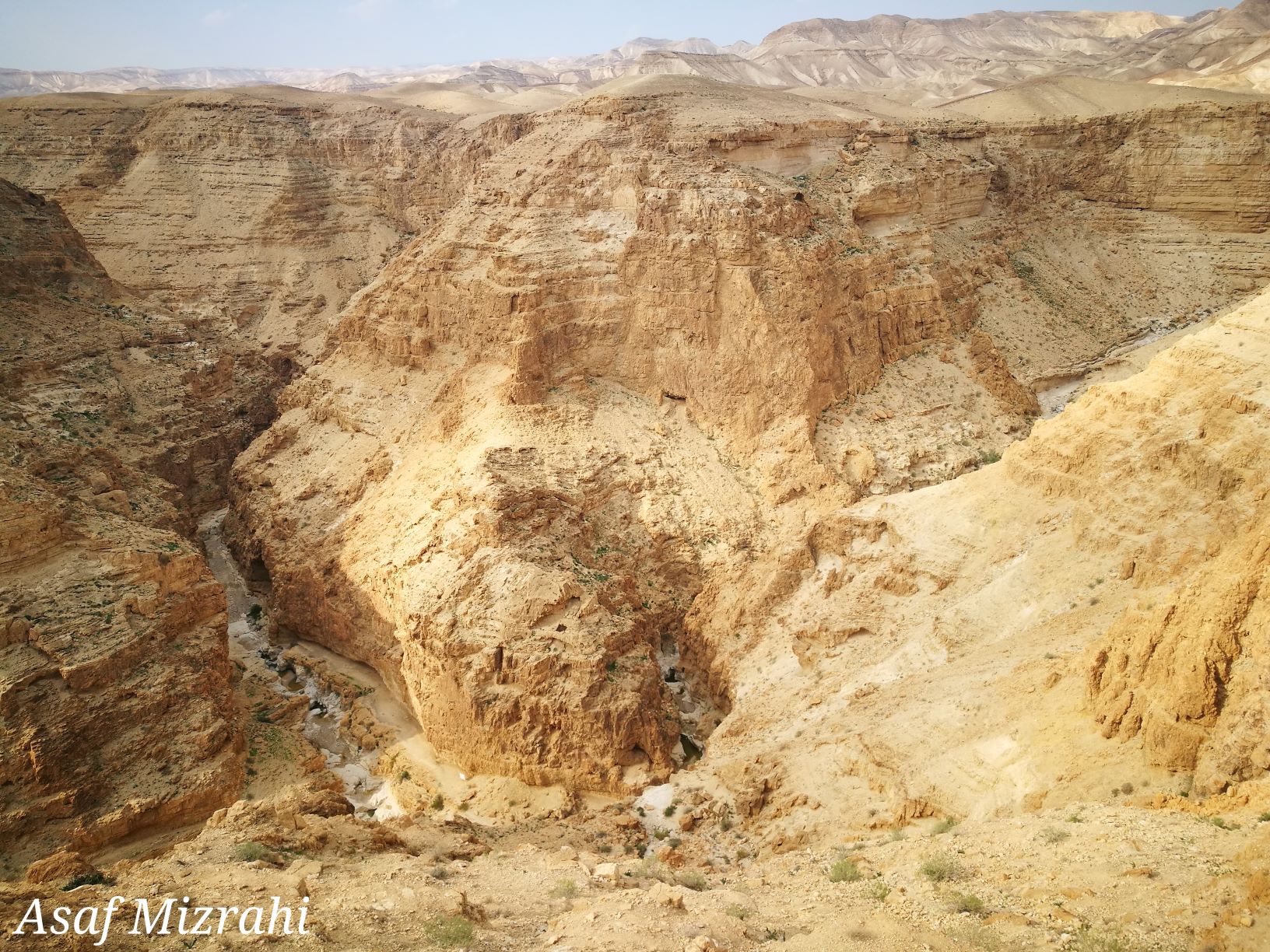
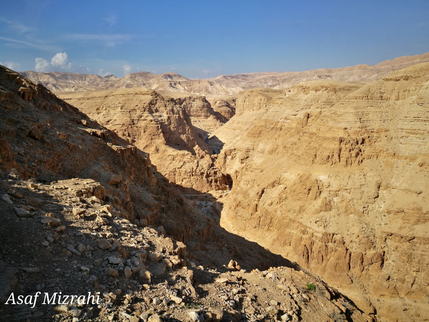
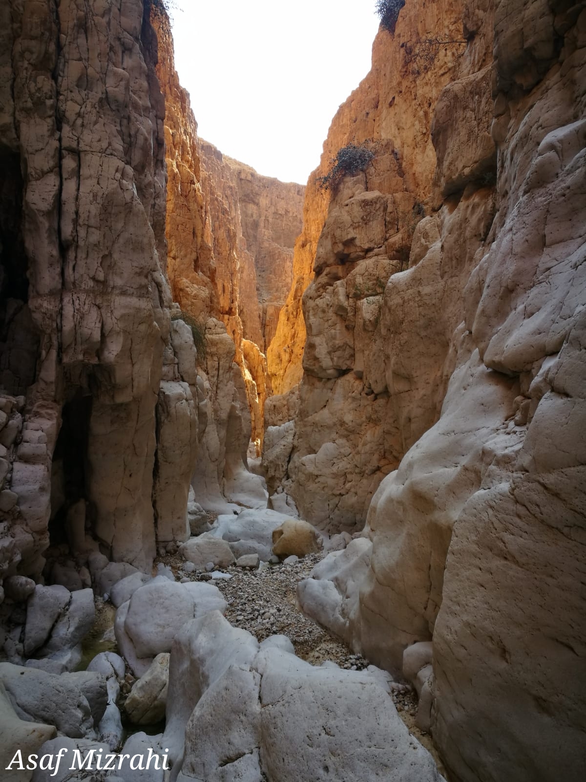
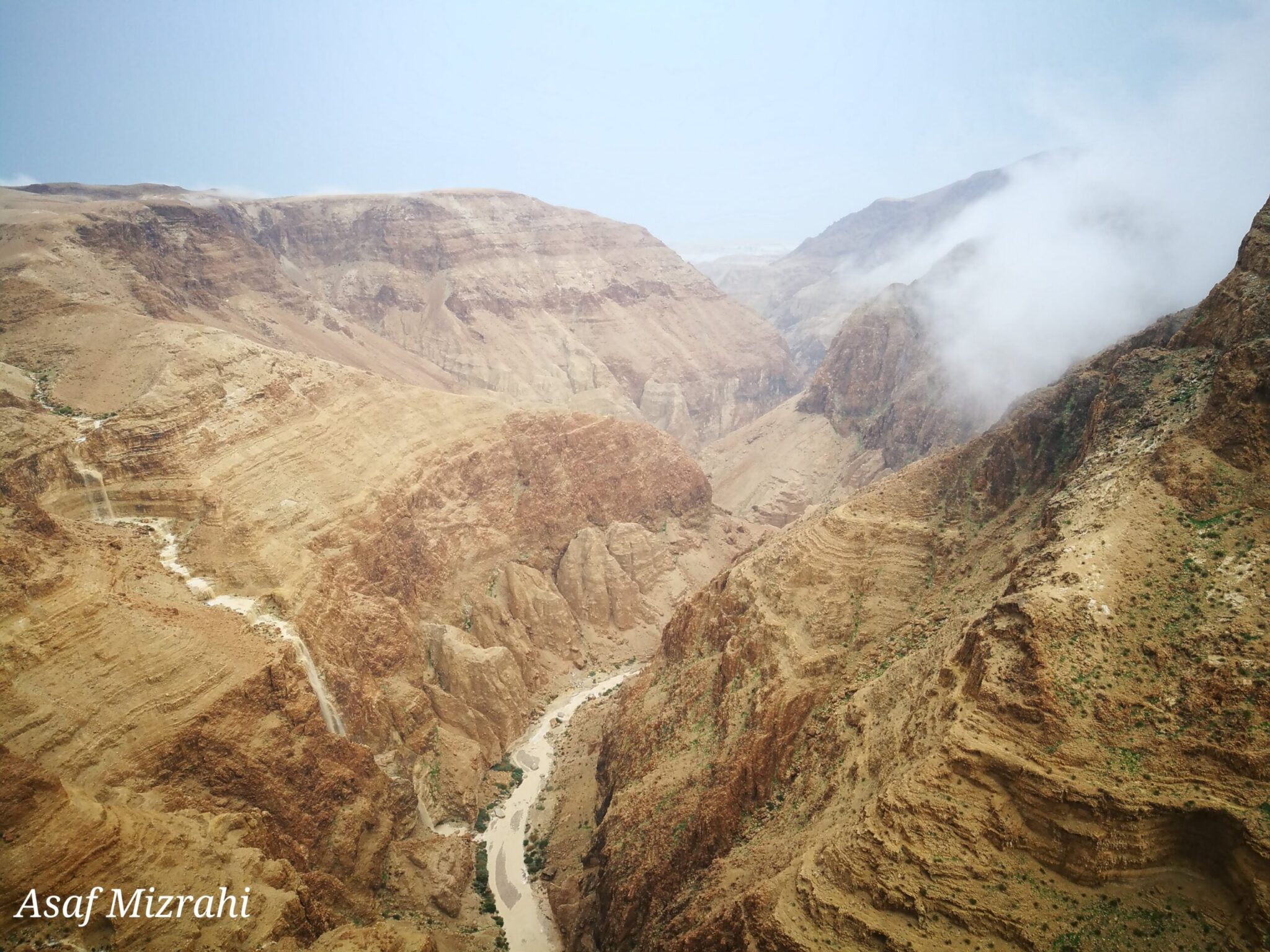
Skip to content

Nahal Darga

Share place

The Nahal Darga canyon is one of the most challenging, difficult and beautiful hiking trails in Israel.

The black-marked path, descending to the bottom of the gorge, passes close to Mashash Muraba’at – a pair of rectangular-shaped caves used by Bar Kochva and his warriors as a place of refuge to hide in. In one of the caves, a scroll was found containing the explicit name of Shimon Bar-Kochva, the leader of the uprising.

The start of this challenging route, is at the confluence of Nahal Darga and Nahal Tekoa. Safety measures are in-place along the route.

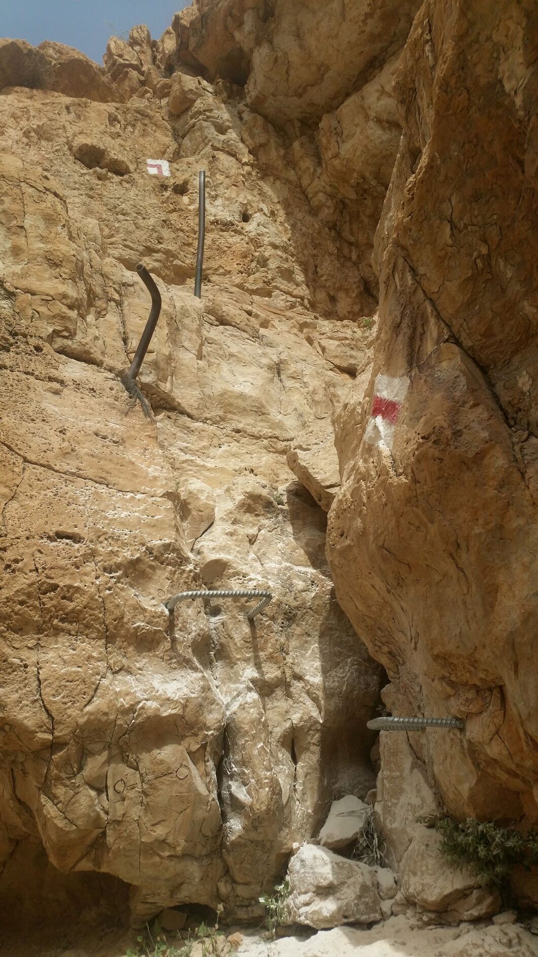
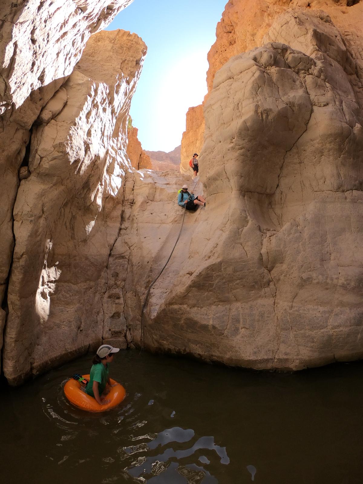
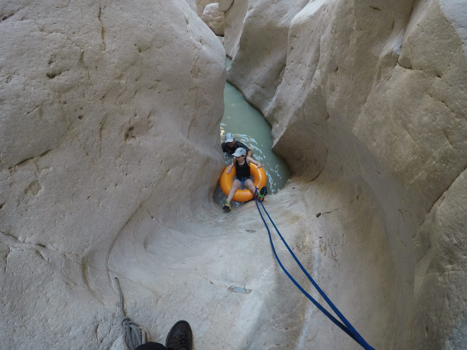
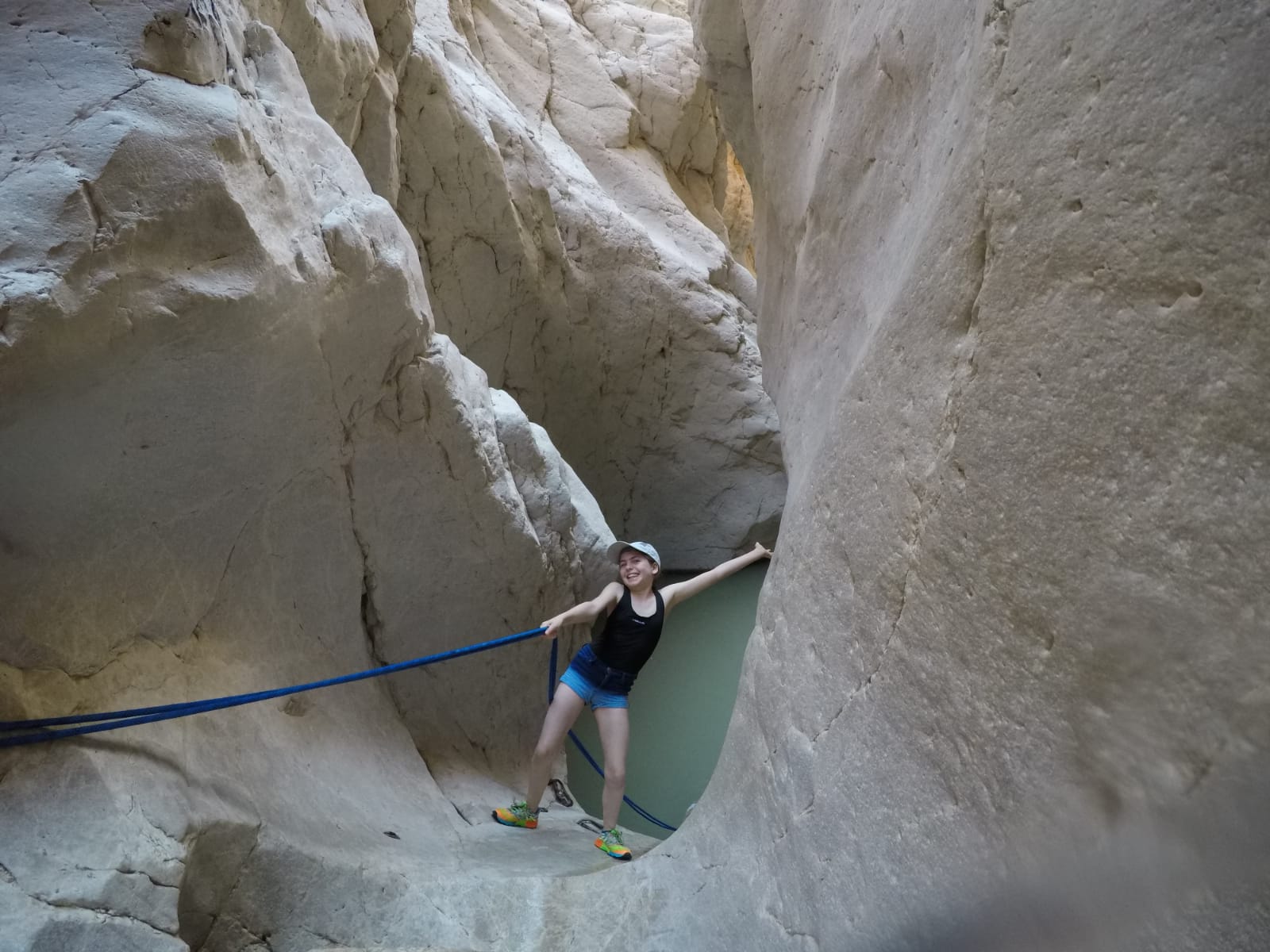
The track combines climbing down waterfalls by aid of ropes, and crossing cool water caverns by immersion and swimming.

The trip to the stream requires advance registration on the Nature Reserves and National Parks Authority website. It is mandatory to come equipped with a suitable rappelling-rope, according to the number of hikers, with a length of 30 meters.

In stormy and rainy weather, it is strictly forbidden to enter the stream for fear of flash-flooding.

  • Trail Length: approx. 9 kilometers
  • Trail Duration: approx. 8 hours
  • Suitable for good walkers and challenge-seekers.
  • Recommended Season: spring/autumn/winter
  • Trail Map: #8
  • Trail Marks: Color Green 8433/ Color Black 8426/ Color Green 8428
  • Starting Point: the Information Center close to Metzoke Dragot Holiday Village
  • Finishing Point: on the Nahal Darga bridge on Route 90


Please note:
you should bring sealable plastic bags for your phone and other articles that are important to keep dry. There is no avoiding full immersion in the water, including your equipment.

The itinerary, as described above, is a recommendation only, and those who choose to take this trip do so at their own discretion and responsibility. The Regional Councils will not be held accountable in the event of any adverse consequences that may ensue.

General details about the place
  • Degree of Difficulty: for good walkers
  • Entering Water
  • Free Entry
  • Linear trip
  • Night Camp
  • Picnic area
  • Requirement for Ancillary Equipment
  • Suitable alone
  • Walking trail
Location on the map
Leave details and we will get back to you
Additional experiences that may interest you
Tracks

Rahaf Stream

Rahaf Stream is located south of Masada in one of the most beautiful and  impressive canyons in the Judean Desert. The stream begins in the Judean Desert  and ends in the Dead Sea, near Mount Elazar. It is 20 kilometers long with a  drainage area basin of nearly 80 square kilometers. The stream begins in the  Kenaiim Valley between Masada and Arad. From there, it makes its descent into  the Dead Sea. In Arabic, the stream is called “Wadi Khafaf,” which means “river  with rustling wings.”  The canyon of the stream is narrow and deep with many waterfalls and rapids. It  can be a challenging route and is suitable for rappelling, descending between the  rocks, crossing waterfalls with the help of ropes, and crossing the stream itself with  ropes, which can fill up after floods. In the middle of the canyon, at the point which  opens up a little and can be reachable without rappelling equipment, there is a  deep, shady, and beautiful ridge that was found filled for several months following  floods.​ At the stream, you’ll encounter Tristam’s starlings, which sometimes get so close  that they’ll eat from your hand.  There are green and blue trail marking throughout the route.    The itinerary, as described above, is a recommendation only. Those who choose to take  this trip do so at their own discretion and responsibility. The Regional Councils will not be  held accountable in the event of any adverse consequences that may occur. 
Tracks

Nahal Tamar – Nahal Tzafit

The Nahal Tamar/Nahal Tzafit trail, is a fascinating and challenging route with ladders, ropes, rock-stairs and, of course, a lookout-point...
Tracks
Duration: 01:00 hours

Ein Plutit

Ein Plutit is the perfect place for those who want to dip their feet in the water, without all that...
Cookies

This website use cookies to improve site functionality, provide you with a better browsing experience, and to enable our partners to advertise to you.

Detailed information on the use of cookies on this Site, and how you can decline them, is provided in our cookie policy.

By using this Site or clicking on “I agree”, you consent to the use of cookies.

On the map